この記事の3行まとめ
- Overture Maps Foundationがオープンマップデータのアルファ版を公開
- ボストンやシカゴなどの都市にある600万以上の建物の高さを表示できるように
- Overture Maps Foundationの運営メンバーにはAmazon.com、Meta、Microsoftなどの企業も
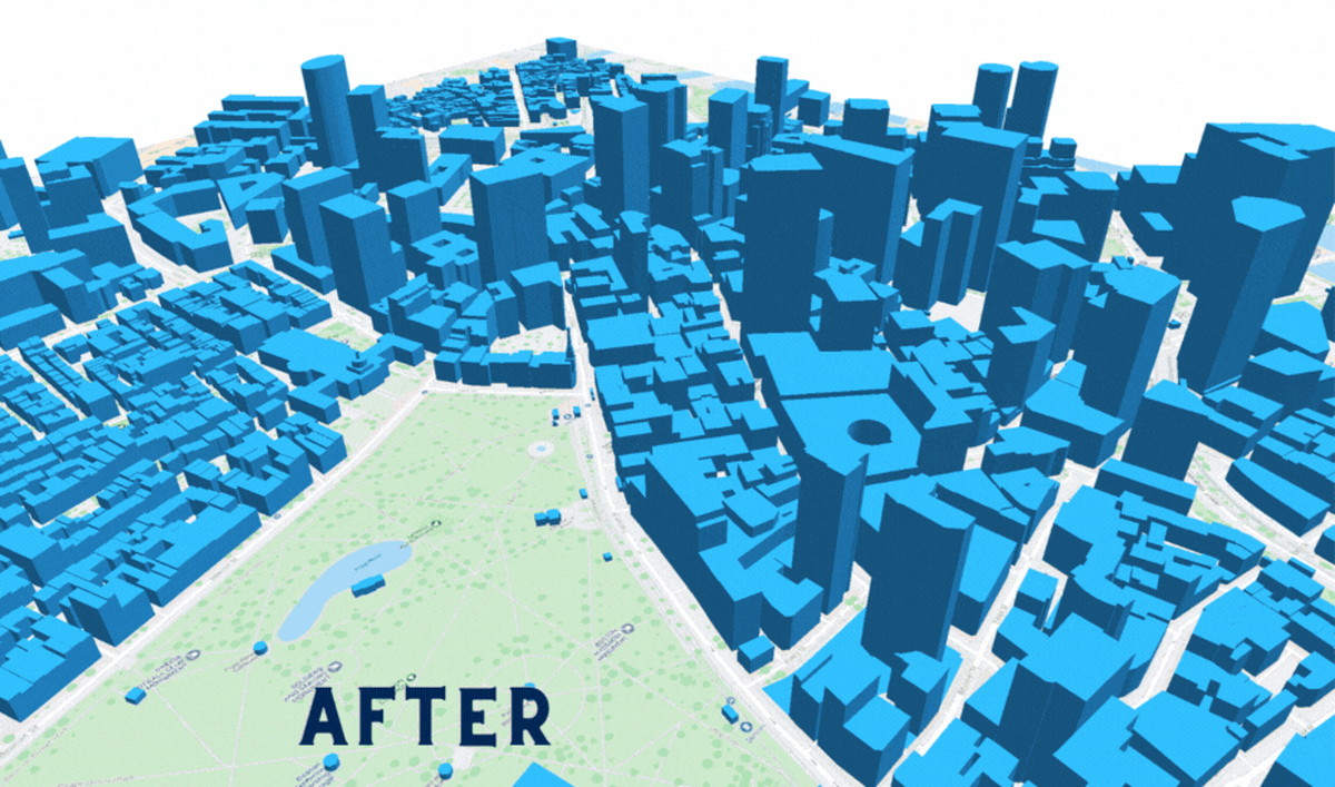
Overture Maps Foundationはオープンマップデータのプレリリースデータセット「Overture 2023-04-02-alpha」を公開しました。これにはボストン・シカゴ・サンタクララなど約34,000平方マイルの範囲にある600万以上の建物の高さなどが含まれ、サイズ容量は約89GBにおよびます。
Overture Maps released an alpha version of open map data showcasing over 6 million 3D buildings that had been derived from @USGS 3DEP lidar and open building footprint data.
Smaller files of building data are available for download. Check it out:https://t.co/VEF71F1tP1 pic.twitter.com/b8cD2CB4Lv
— Overture Maps Foundation (@OvertureMaps) April 13, 2023
Overture Maps Foundationは2022年12月にThe Linux Foundationによって設立され、現代のマップ市場ニーズを満たすオープンマップデータの構築を目指しています。
Overtureのマップは会員・市民団体・オープンデータソースなど複数のソースから取得されたものを構造化して結合することで、相互運用を簡略化。また、マップデータのエラー・破損・破壊行為を検出しており、データが使用可能であることを保証(※)しています。Amazon.com、Meta、Microsoft、TomTomは同団体の運営メンバーです。
※ 今回リリースされたデータはアルファ版のため、実用の想定はされていません
今回のリリースデータには、USGSの3D標高プログラム(3DEP)のLiDARデータを使用しています。また、OpenStreetMapやMicrosoftのbuilding footprint dataなどを比較し、高さを検証。イリノイ州クック郡、ワシントン州キング郡などのエリアのGeoJSONデータも配布されています。
データが追加され、一部地域の建物の高さを可視化できるように(画像はOverture Maps Foundation公式ブログより引用)
公開されたデータは、CDLA Permissive V2.0およびODbLライセンスの下で利用可能です。
詳しくは、Overture Maps Foundation公式ブログおよびリリースノートをご確認ください。
『Overture Maps Foundation Update – A Look at Progress, Possibilities』Overture Maps Foundation公式ブログDownload Overture Maps DataOverture April Alpha Release Notes


